Pair north with west.
Use Mefjordvær or Fjordgård for the northern villages, then Skaland or Hamn for the west and south. Four nights is a minimum; six lets weather reshape the plan.
See the two-base plan ↓Regional guide · Troms · Norway
Toothed peaks, sheltered forests and fishing villages threaded by one magnificent road.
Choose the coast first · Two coasts, one wild island
One road links the island, but fjords, ferry timings and mountain weather divide the experience. Make three decisions before adding the viewpoints.
Use Mefjordvær or Fjordgård for the northern villages, then Skaland or Hamn for the west and south. Four nights is a minimum; six lets weather reshape the plan.
See the two-base plan ↓Roadside landscapes work in every season when roads are safe. Hesten, Husfjellet, kayaking and museum opening each have narrower normal windows.
Check month-by-month limits ↓Botnhamn can connect towards Tromsø and Gryllefjord towards Andøya, but both use dated seasonal timetables. The mainland bridge through Finnsnes is the dependable alternative.
Check official route information ↗The landscape, for real
Real photographs from Wikimedia Commons. Each image links to its author and licence record; crops are used only for presentation.
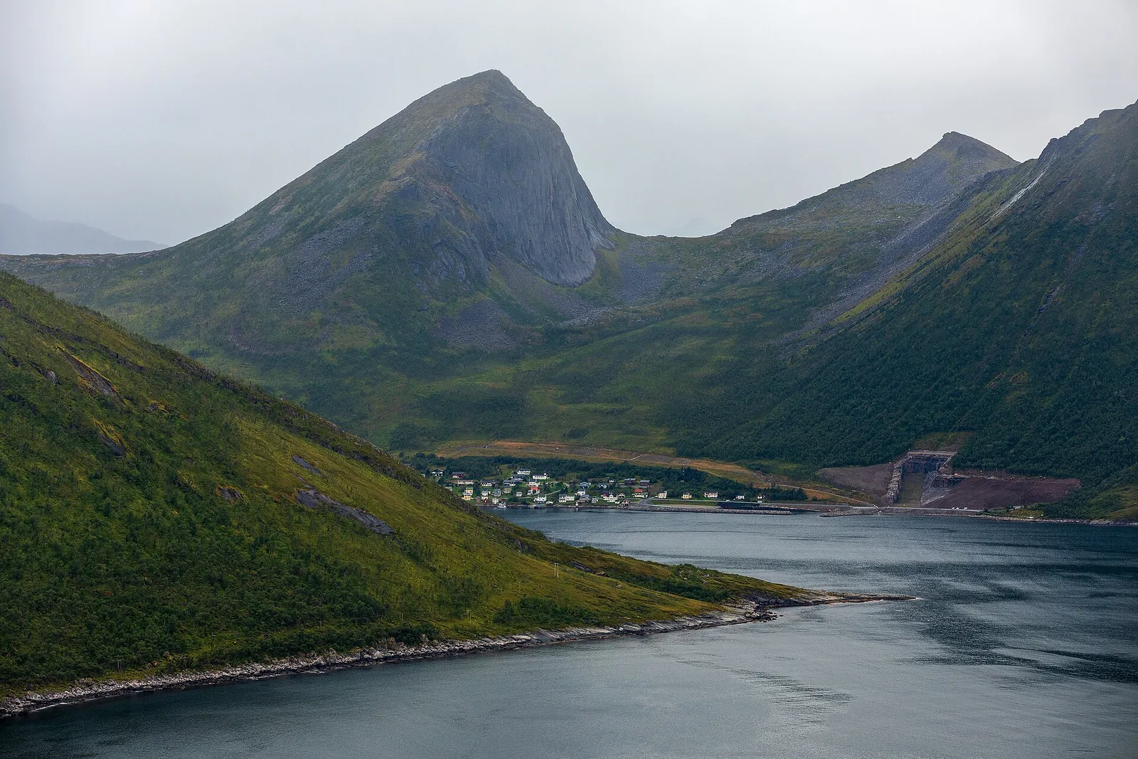
Fjordgård village and Segla mountain across Trælvika on Senja
Simo Räsänen · CC BY-SA 4.0 ↗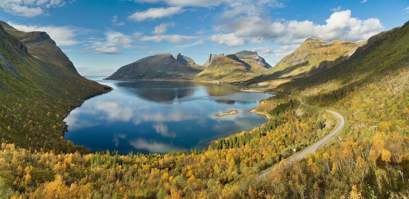
Bergsbotn and Bergsfjorden seen from the scenic viewpoint on Senja
Simo Räsänen · CC BY-SA 3.0 ↗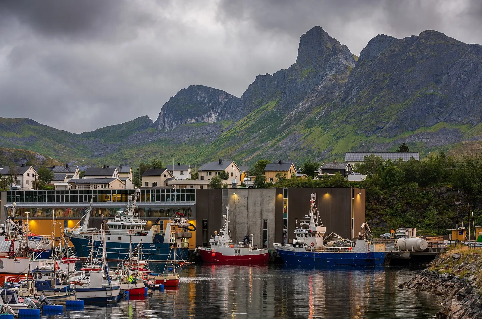
Fishing boats and working harbour buildings on Husøy in northern Senja
Simo Räsänen · CC BY-SA 4.0 ↗A little context · independently sourced
Senja, or Sážža, is a Sámi cultural landscape where Sámi, Kven and Norwegian lives have long overlapped. Fishing, small-scale farming, hunting and seasonal use of coast and interior remain visible in place names, museums and living traditions.
Read the historical sourceVisit Senja Region · Sámi heritagePlanning notes · sourced from official visitor information
Open any idea for its editorial detail, practical notes and sources.
Follow 102 kilometres of coast between Botnhamn and Gryllefjord, making the published detours to Mefjordvær and Husøy part of the day rather than treating Senja as a fast through-route.
FoodSalteriet5.5 km straight-line from Drive Norwegian Scenic Route Senja
Indoor alternativeWalk Mefjordvær’s harbour edge5.6 km straight-line from Drive Norwegian Scenic Route Senja
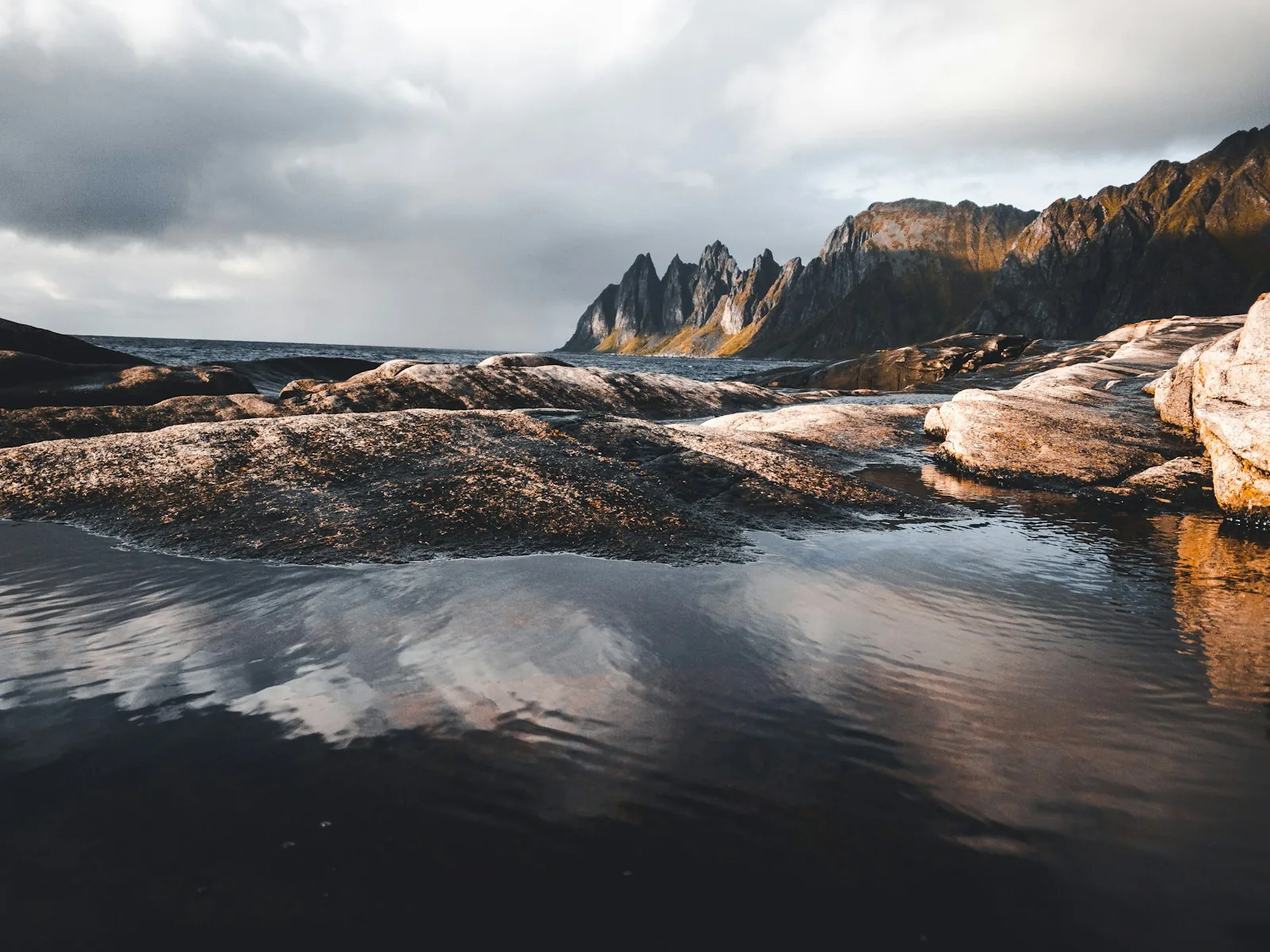
Viewpoint or outdoorsWalk the timber line at Tungeneset50 m straight-line from Drive Norwegian Scenic Route Senja
Check road and ferry status on the day. Snow, wind, roadworks and narrow sections can change the pace substantially.
Check official informationNorwegian Scenic Routes · SenjaA Siberian-larch walkway crosses the rocks towards the sea, bringing the serrated Okshornan peaks into view without requiring a mountain hike.
FoodSalteriet5.5 km straight-line from Walk the timber line at Tungeneset
Indoor alternativeWalk Mefjordvær’s harbour edge5.6 km straight-line from Walk the timber line at Tungeneset
Viewpoint or outdoorsDrive Norwegian Scenic Route Senja50 m straight-line from Walk the timber line at Tungeneset
The official authority marks the facility wheelchair accessible. Toilets normally open from early May to early October; winter ice can alter access.
Check official informationNorwegian Scenic Routes · TungenesetFollow the breakwater around a working fishing village where boats, quays and mountain walls explain the outer coast more clearly than another high viewpoint.
FoodSalteriet200 m straight-line from Walk Mefjordvær’s harbour edge
Indoor alternativeRead the fishing village of Husøy on foot9.1 km straight-line from Walk Mefjordvær’s harbour edge
Viewpoint or outdoorsPause at Ersfjordstranda5.0 km straight-line from Walk Mefjordvær’s harbour edge
Stay clear of working quays and machinery. Add the Russehula coastal path only when ground and sea conditions are suitable.
Check official informationNorwegian Scenic Routes · MefjordværHesten gives the familiar side-on view of Segla, but the reward follows a steep, often muddy ascent above Fjordgård rather than a roadside photo stop.
Fjordgård; follow current local signs from the village approach
Mountain path with grass, mud and rock
Hesten 556 m; roughly 500 m of ascent
About 3–4 hours return
Confident hikers in dry, settled summer or early-autumn conditions
FoodMulegga4.1 km straight-line from Climb Hesten for the Segla view
Indoor alternativeRead the fishing village of Husøy on foot4.1 km straight-line from Climb Hesten for the Segla view
Viewpoint or outdoorsPause at Ersfjordstranda9.7 km straight-line from Climb Hesten for the Segla view
The pin marks the Fjordgård approach, not a guaranteed parking place. Snow, wet rock, wind and poor visibility can make the route inappropriate.
Check official informationVisit Senja Region · guided mountain adventuresFrom Tranøybotn, a prepared gravel approach and family trail lead through wetland and old pine towards the national park’s quieter inland landscape.
Tranøybotn entry point and surface car park
Prepared gravel track, then family nature trail
Low-level route; no summit objective
About 2–3 hours for the 4.5 km family loop
Families and walkers wanting a lower-level alternative
FoodSenja by Heart Restaurant21 km straight-line from Follow Ånderdalen’s family nature trail
Indoor alternativeBegin the south-island story at Sážžá6.5 km straight-line from Follow Ånderdalen’s family nature trail
Viewpoint or outdoorsKayak the sheltered south coast with a guide6.5 km straight-line from Follow Ånderdalen’s family nature trail
The park describes the complete family nature trail as about 4.5 km. Snow and maintenance can alter the prepared surface outside the normal walking season.
Check official informationÅnderdalen National Park · gatewaysUse the nature centre and museum in Tranøybotn to understand Sážža, Ånderdalen and the Sámi, Kven and Norwegian histories that share the island.
FoodSenja by Heart Restaurant24 km straight-line from Begin the south-island story at Sážžá
Indoor alternativeVisit the Kaperdalen Sámi settlements5.1 km straight-line from Begin the south-island story at Sážžá
Viewpoint or outdoorsKayak the sheltered south coast with a guide50 m straight-line from Begin the south-island story at Sážžá
Opening varies. The source confirms the venue and exhibitions but does not publish detailed access measurements.
Check official informationVisit Senja Region · SážžáAccess, checked place by place
Only details published by the responsible road authority, park or venue appear here.
Place-by-place records · missing facts remain unverifiedMore ways to use the guide
Open compact one-, two- and three-day starting points, plus rainy-day, family and low-cost groupings.
Additional ideas drawn from the sourced activity catalogueLive conditions · guide context
Four versions of the place
A seasonal starting point built from the guide’s researched ideas.
Split time between the scenic road, villages and one well-chosen hike.
Month by month · checked 23 August 2026
This describes normal seasonal suitability, not live availability. Weather, snow, sea state, daylight, closures and operator decisions take priority.
A sensible month to plan this, subject to current conditions and opening.
The road and landscape remain relevant year-round, but winter road conditions, short daylight, ice and closed seasonal toilets can limit a stop.
Norwegian Scenic Routes · SenjaHusøy, Mefjordvær and Gryllefjord are living communities rather than seasonal attractions. Food, museums and visitor services may keep reduced hours outside summer.
Norwegian Scenic Routes · SenjaThe prepared Tranøybotn approach is normally easiest in the snow-free months. Snow, flooding and maintenance can alter its accessible surface.
Ånderdalen National Park · gatewaysTreat July to September as the normal summer-hiking window. June can retain snow; October can bring ice, short light and winter conditions.
Visit Senja Region · mountain adventuresThe broadest normal window is late spring to early autumn. Wind, swell and cold water still determine the launch on every date.
Visit Senja Region · guided kayakingOperator schedules and wildlife patterns vary; departures are normally easiest to plan in the lighter months and remain weather-dependent.
Visit Senja Region · fjord and wildlife safariDarkness is normally sufficient from September to March. Clear sky, solar activity and safe access still need to align.
Visit Senja Region · northern lightsPossible in some circumstances, but keep a flexible alternative.
Midt-Troms Museum lists visits by request between May and September rather than continuous drop-in opening.
Midt-Troms Museum · KaperdalenThese sea links use dated seasonal timetables. Never infer a sailing from the month alone.
Norwegian Scenic Routes · ferry linksOutside the usual season or not a dependable normal plan.
Requires sufficient snow and a guide-selected route. November and April are transitional rather than dependable winter months.
Visit Senja Region · snowshoe hikeThe local table
Independent editorial starting points, never paid rankings.
Mefjordvær · north-west coast
Local ingredients and regional traditions in an informal room filled with objects and photographs from Mefjordvær’s coastal past.
Hamn · western Senja
A harbour-facing dining room at Hamn built around Arctic ingredients, local seafood and a short walk back to the water after dinner.
Detailed geography & travel times
Open the north-coast, outer-west and south/interior tables, two-base plan, road times and ferry context.
Detailed planning ranges · not live trafficA map worth planning with
Beaches, museums, trailheads, harbours, restaurants, car parks, ferry terminals and verified access facilities are separated into useful layers. The Scenic Route follows published road geometry—not one vague marker in the middle of the region.
Coordinates were checked 23 August 2026. The coral line follows published Scenic Route geometry; pins link to their location source.
Gateway city
Tromsø is outside Senja. In season, the Brensholmen–Botnhamn ferry can shorten the northern approach; the mainland road through Finnsnes remains the alternative when sailings do not fit.
Check the official Senja connectionsFour anchors
Before you go
Fly to Tromsø or Bardufoss, then connect by seasonal ferry, express boat or road. A hire car is useful; check ferry timetables and road conditions before each transfer.
Distances look short on a map, but narrow roads, ferries and weather make progress slower. Base yourself in two parts of the island rather than changing beds every night.
Spring · Summer · Autumn · Winter
Keep looking north
Ersfjord · Scenic Route Senja
Ånderdalen National Park
Museums & food venues
Tranøybotn · south Senja
Kaperdalen · interior Senja
Frovåg · south Senja
Gryllefjord · west coast
A harbour-side place named for migrating Arctic cod, serving fish alongside northern meat dishes and occasional food-and-music events.
Torsken · south-west coast
A compact fjord-facing restaurant using seafood from nearby processing and other locally sourced ingredients, best treated as a planned dinner rather than a casual stop.
Husøy · north-east coast
A contemporary room on Husøy where local seafood and delicacies from land make a useful food anchor for the island detour.
Skaland gives the easiest start for Husfjellet and everyday supplies; Hamn trades convenience for a quieter harbour setting.
Wheels-turning estimates
Planning ranges include a modest buffer but no meals, photographs, roadworks or winter delays. They are not live traffic.
Distances are rounded planning estimates. Open the official road and journey planners before departure.
Regional guide · Sea-to-summit Arctic
A serrated mountain peninsula where fjord-level days rise into landmark hikes and world-class ski touring.
Frovåg · south Senja
A southern-island table cooking from scratch with fish from the coast, boknafisk dried at Frovåg and meat from local farmers and hunters.